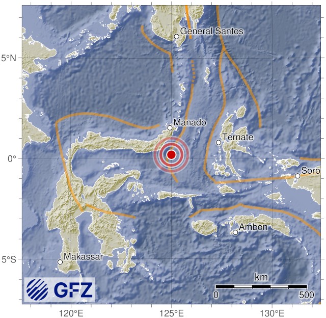
| F-E Region: | Minahassa Peninsula, Sulawesi |
 |
| Time: | 2025-04-17 00:51:24.9 UTC | |
| Magnitude: | 5.6 (Mw) | |
| Epicenter: |
124.89°E 0.49°N
| |
| Depth: | 17 km | |
| Status: | M - manually revised |
| Method | Origin Time UTC | Mag | Latitude degrees | Longitude degrees | Depth km |
Strike | Dip | Rake | |
|---|---|---|---|---|---|---|---|---|---|
| GEOFON standard1 | 2025-04-17 00:51:25 | 5.6 | 0.48°N | 124.88°E | 20 | 286 28 |
75 52 |
140 18 |
 |
- GEOFON standard inversion using body and surface waves. [Details].
Back to the earthquake list
© Helmholtz-Zentrum Potsdam Deutsches GeoForschungsZentrum GFZ