
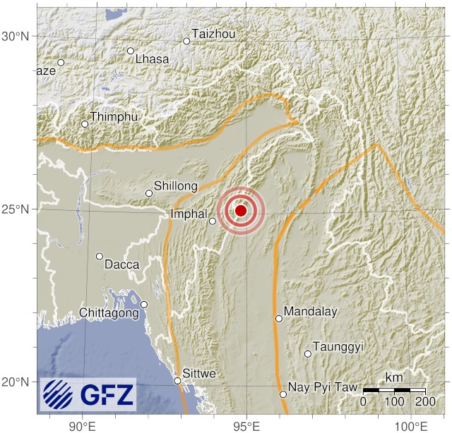
| F-E Region | Myanmar-India Border Region |
| Time | 2026-06-20 04:33:01.2 UTC |
| Magnitude | 4.6 (mb) |
| Epicenter | 94.82°E 25.09°N |
| Depth | 10 km (fixed) |
| Status | A - automatic |
Disclaimer:
Unless revised by a geophysicist, automatically determined earthquake parameters may be erroneous!
More about locations
More about locations
This is a product of the
GEOFON Extended Virtual Network (GEVN) and credit belongs to all involved institutions.
Information, including images, shown on this page are
licensed under a Creative Commons Attribution 4.0 International License.
